Route: From Coldingham village to Coldingham Sands, along the coast path to St Abbs and back to Coldingham via the Creel Path.
Distance: 6.39km/4miles
In 616AD Aethelfrith, first King of Northumberland, was killed in battle. His family, including his daughter Æbbe fled northwards finally settling on Iona where they were converted to Christianity. Later Æbbe established a community of monks and nuns at Kirkhill – now known as St Abb’s Head.
In 683AD Æbbe died. The settlement at Kirkhill was subsequently destroyed by fire, an act of God, meant to punish the wayward behaviour of the monks and nuns!!
Later permission was given by Edgar, the first ruler of England to establish in Scotland, to build a new church at the more sheltered site of Coldingham. And it was this church, consecrated in 1098AD, that was eventually to become one of Scotland’s most important priories.
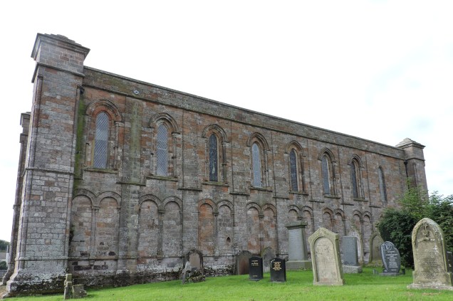
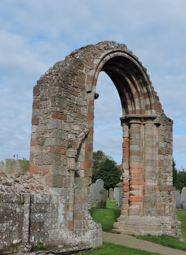
Coldingham Priory, the parish church of Coldingham as it looks today after several rebuildings.One of the most striking features of the Priory. The arch is built of sandstone and stands next to the church – it’s possibly a reconstruction built on the original base.
Bell Tower, Coldingham Priory
See the chain, to ring the bell?
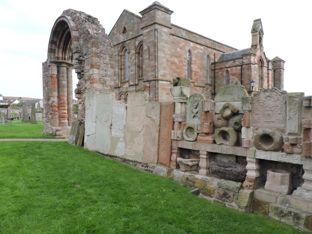
Lapidarium – a collection of carved masonry and gravestones. Some of these relics date back hundreds of years and include a basin that is believed to have originated from the original monastery.In the Priory garden are stones carved with inscriptions written by members of the Friends of Coldingham Priory alongside local school children. The stones represent the early saints of Northumberland who influenced the siting of the Priory at Coldingham.
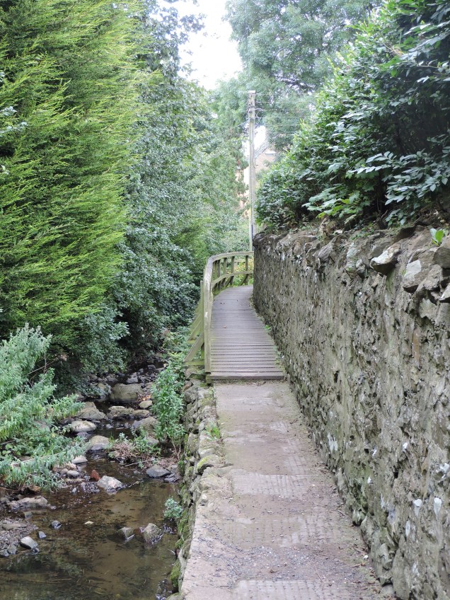
Our route takes us out of the village via a downhill path which leads us across a ford and onto a track beside the burn.
Bogan Burn – the cottages that run alongside the burn housed cotton and linen weavers who produced Coldingham Gingham. The last weaver died in 1900.
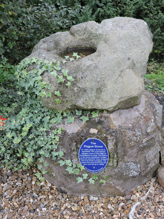
Along the way we pass the Plague Stone recovered from the burn in 2008:
Scotland lost over a quarter of its population as a result of the Bubonic Plague outbreak of 1645.
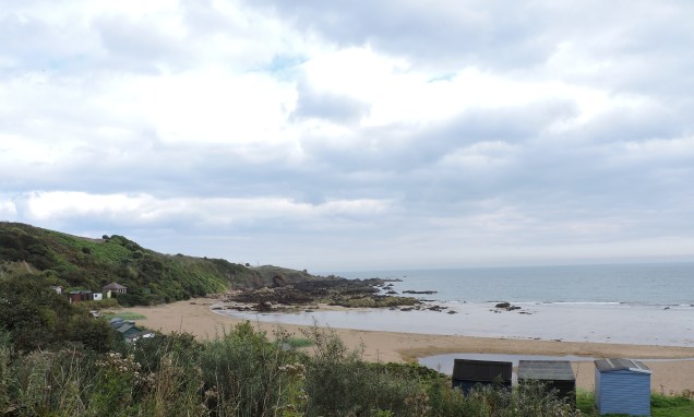
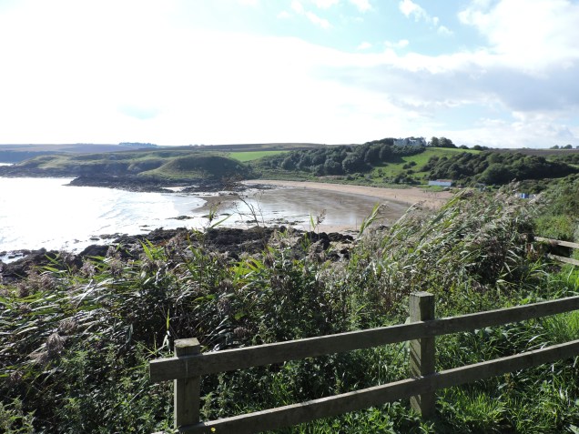
Emerging from the burnside pathway we follow the road opposite past a large holiday park, along a hedge lined track and downhill with views of Coldingham Bay ahead.
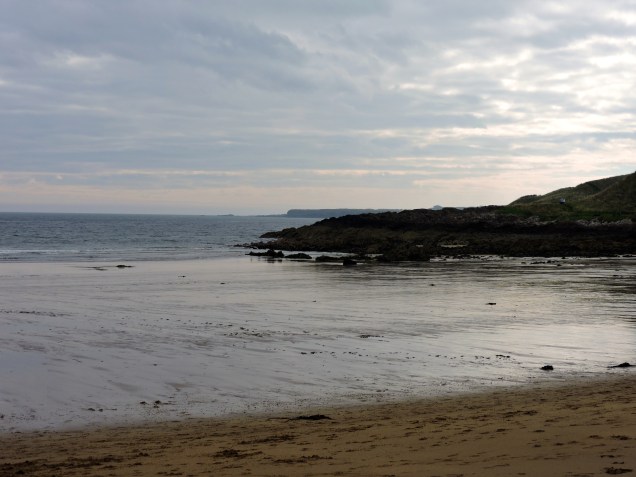
The beach at Coldingham Bay has received the Seaside Award – for less developed beaches and the top award from The Marine Conservation Society for cleanliness. It was also awarded the Blue Flag in 2010.
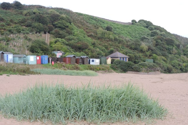
The line of beach huts on the sands, some are thought to be over 100 years old.
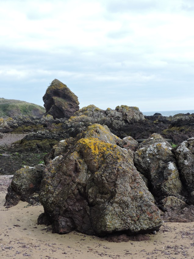
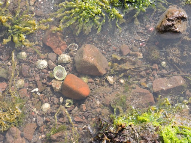
It’s so lovely to see the sea and smell the seaweed! Mr RR has gone off driftwood hunting (no luck there) and I wander alone towards the rocks.Is it me or does the one in the foreground look like a giant tortoise?I’d nearly forgotten about rock pools….this one was teeming with life but all of it managed to avoid the camera!
We finally leave the sand behind and head up steep steps towards the coast path which will lead us along to St Abbs.
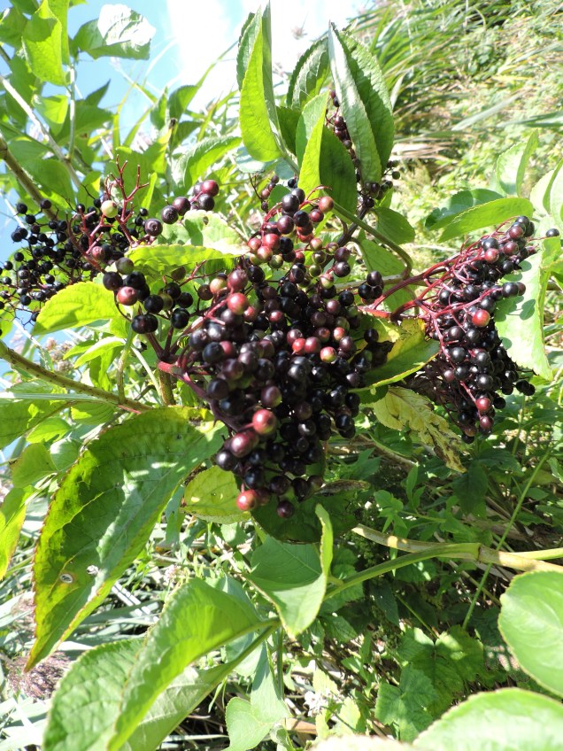
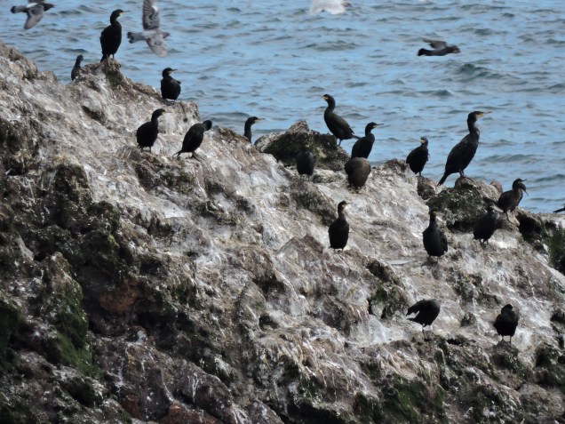
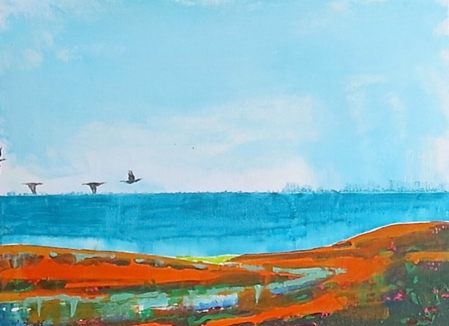
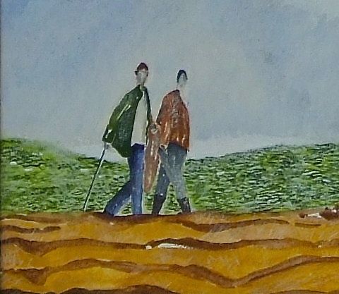
Elderberries – nearly ready for picking.The view over Coldingham Bay from the coast pathA Swim of Cormorants on the rocks belowPassing Cormorants – mixed media on board.
Æ
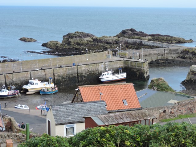
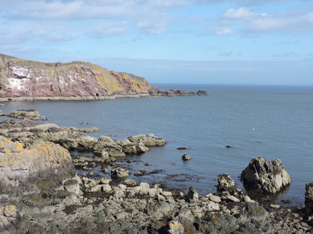
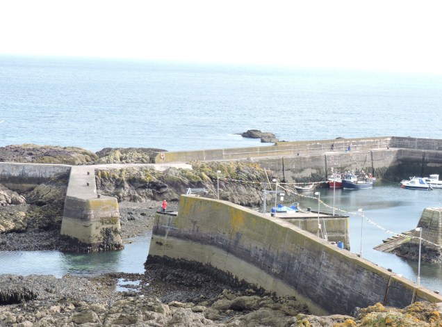
We follow the coast path just a short way before we reach the little harbourside village of St Abbs
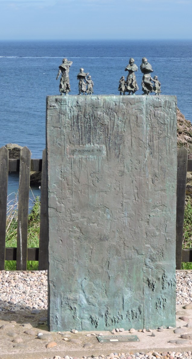
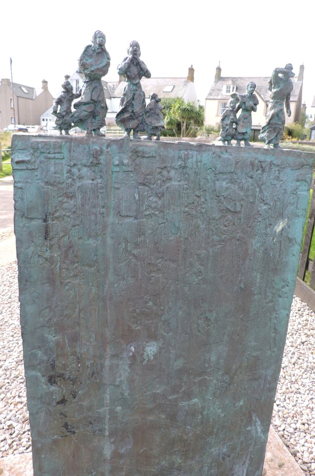
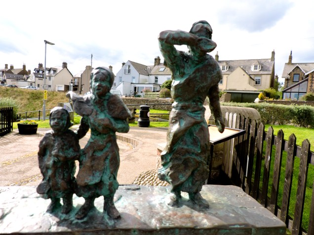
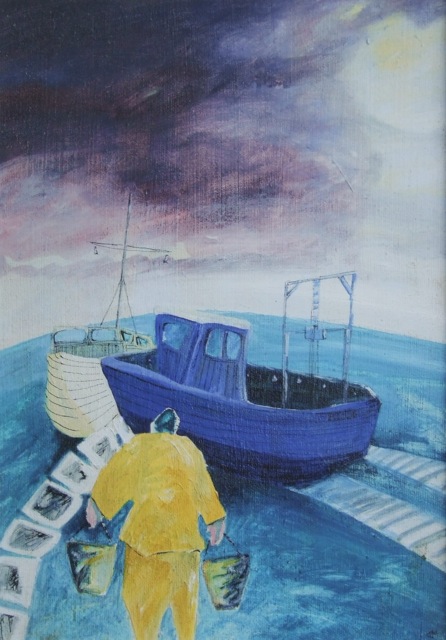
St Abbs is unusual in that it is owned by the residents of the village and not by the local council. It is managed by the Harbour Trust made up of local residents and fishermen. In the past funding for repair of the harbour walls came from the Scottish Executive but they are now mostly dependent on contributions and donations.The view to the north towards St Abb’s Head.At the top of the hill, overlooking the sea and next to the visitor centre is this evocative bronze sculpture by Jill Watson.These figures represent the wives and children of three men from St Abbs lost in the great storm of 1881.189 fishermen from the east coast of Scotland perished on that day.Its peaceful here today.Waiting for the Tide – Acrylic
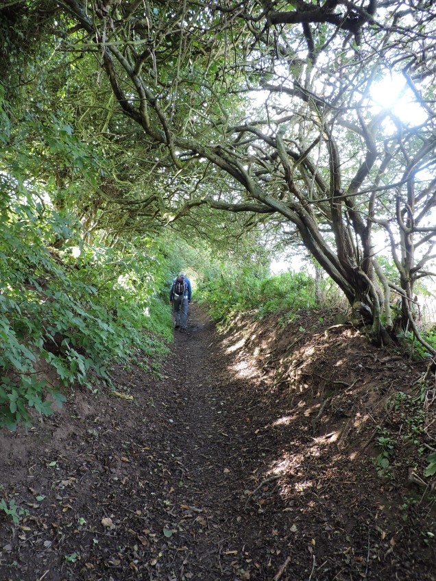
We walk a little way through the village until we find the Creel Path which will take us back to Coldingham
In use for over 1000 years, the Creel Path was historically used by fishermen who lived in Coldingham to get to their boats at what was then known as Coldingham Shores before the current village of St Abbs was developed. The path is deep sided and tree lined.
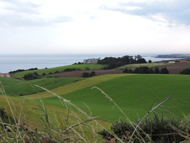
We leave the Creel Path and emerge onto the road back into Coldingham taking a last look at those views
before arriving at the village for lunch
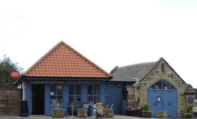
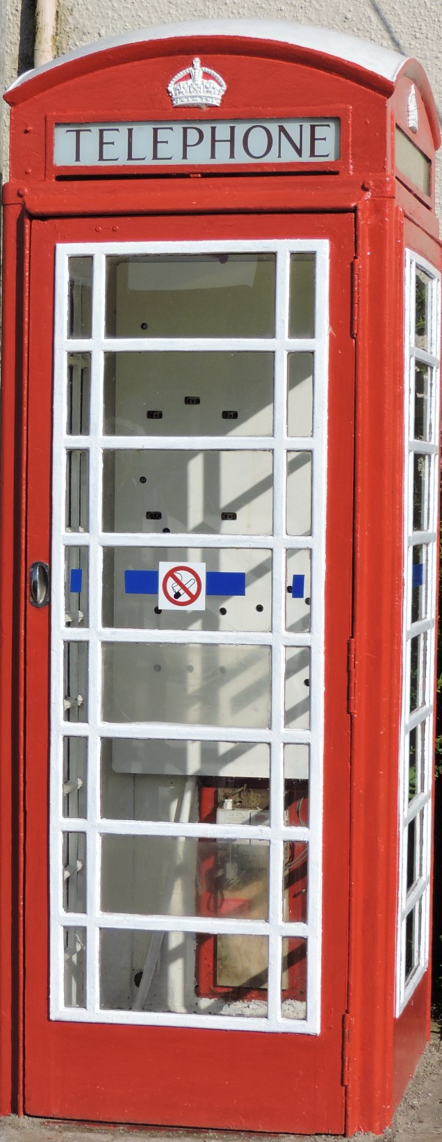
Coldingham Luckenbooth – a combination of Post Office, visitor centre and cafe – we had delicious fried egg sandwiches and jolly good tea and coffee!Coldingham has the cleanest, most neatly painted telephone booth I have ever seen! No telephone in it though. By the way – it also has the cleanest, most beautifully decorated public toilet I have ever seen!


One thought on “Coldingham Priory circular via St Abbs”